Asabiya: Difference between revisions
Jump to navigation
Jump to search
No edit summary |
No edit summary |
||
| (3 intermediate revisions by 2 users not shown) | |||
| Line 16: | Line 16: | ||
|other_symbol_type = <!--Use if a further symbol exists, e.g. hymn--> | |other_symbol_type = <!--Use if a further symbol exists, e.g. hymn--> | ||
|other_symbol = | |other_symbol = | ||
|image_map = | |image_map = Location map of Asabiya.png | ||
|alt_map = <!--alt text for map--> | |alt_map = <!--alt text for map--> | ||
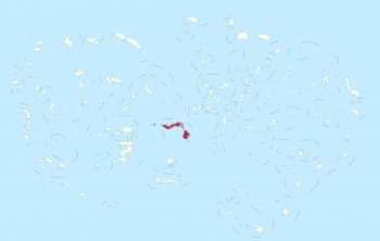
|map_caption = | |map_caption = Location of the Asabiya. | ||
|image_map2 = <!--Another map, if required--> | |image_map2 = <!--Another map, if required--> | ||
|alt_map2 = <!--alt text for second map--> | |alt_map2 = <!--alt text for second map--> | ||
|map_caption2 = <!--Caption to place below second map--> | |map_caption2 = <!--Caption to place below second map--> | ||
|capital = | |capital = Khayzuran | ||
|latd= | latm= | latNS= |longd= |longm= |longEW= <!--capital's latitude and longitude in degrees/minutes/direction--> | |latd= | latm= | latNS= |longd= |longm= |longEW= <!--capital's latitude and longitude in degrees/minutes/direction--> | ||
|largest_city = | |largest_city = capital | ||
|largest_settlement_type = | |largest_settlement_type = largest city | ||
|largest_settlement = <!--Name of largest settlement--> | |largest_settlement = <!--Name of largest settlement--> | ||
|official_languages = <!--Languages recognised in legislation, constitution, etc--> | |official_languages = <!--Languages recognised in legislation, constitution, etc--> | ||
| Line 62: | Line 62: | ||
|established_event9 = <!--(up to nine distinct events may be included)--> | |established_event9 = <!--(up to nine distinct events may be included)--> | ||
|established_date9 = | |established_date9 = | ||
|area_rank = | |area_rank = 76th | ||
|area_magnitude = | |area_magnitude = | ||
|area = <!--Major area size (in [[Template:convert]] either km2 or sqmi first)--> | |area = <!--Major area size (in [[Template:convert]] either km2 or sqmi first)--> | ||
|area_km2 = | |area_km2 = 69226 | ||
|area_sq_mi = <!--Area in square mi (requires area_km2)--> | |area_sq_mi = <!--Area in square mi (requires area_km2)--> | ||
|area_footnote = <!--Optional footnote for area--> | |area_footnote = <!--Optional footnote for area--> | ||
|percent_water = | |percent_water = 0.85 | ||
|area_label = | |area_label = Total | ||
|area_label2 = <!--Label below area_label (optional)--> | |area_label2 = <!--Label below area_label (optional)--> | ||
|area_data2 = <!--Text after area_label2 (optional)--> | |area_data2 = <!--Text after area_label2 (optional)--> | ||
|population_estimate = | |population_estimate = 5,359,958 | ||
|population_estimate_rank = | |population_estimate_rank = | ||
|population_estimate_year = | |population_estimate_year = 2016 | ||
|population_census = | |population_census = | ||
|population_census_year = | |population_census_year = | ||
|population_density_km2 = | |population_density_km2 = 77.4 | ||
|population_density_sq_mi = | |population_density_sq_mi = | ||
|population_density_rank = | |population_density_rank = | ||
| Line 108: | Line 108: | ||
|date_format = DD/MM/YYYY | |date_format = DD/MM/YYYY | ||
|drives_on = Right | |drives_on = Right | ||
|cctld = . | |cctld = .ab عصبية., .ga غانذارا. | ||
|iso3166code = <!--Use to override default from common_name parameter above; omit using "omit".--> | |iso3166code = <!--Use to override default from common_name parameter above; omit using "omit".--> | ||
|calling_code = + | |calling_code = +325 | ||
|image_map3 = <!--Optional third map position, e.g. for use with reference to footnotes below it--> | |image_map3 = <!--Optional third map position, e.g. for use with reference to footnotes below it--> | ||
|alt_map3 = <!--alt text for third map position--> | |alt_map3 = <!--alt text for third map position--> | ||
| Line 120: | Line 120: | ||
}} | }} | ||
'''Asabiya''' ([[Wikipedia:Arabic_language|Arabic]]: عصبية, | '''Asabiya''' ([[Wikipedia:Arabic_language|Arabic]]: عصبية, <i>'Aṣabīya</i>), officially the '''Republic of Asabiya''' ([[Wikipedia:Arabic_language|Arabic]]: جمهورية عصبية, <i>Jumhūriyyat 'Aṣabīya</i>), is an [[Wikipedia:Autonomous_republic|autonomous republic]] of [[Gandhara]], compromising three main landmasses, and numerous smaller islands. It has a population of around 5.3 million people and its territory covers 69,226 km² (26,728 sq mi). | ||
[[Category:Asabiya]] | |||
[[Category:Island countries]] | |||
[[Category:Overseas territories of Gandhara]] | |||
[[Category:Arabic-speaking countries and territories]] | |||
Latest revision as of 13:22, 19 June 2016
Republic of Asabiya
| |
|---|---|
 Flag | |
 Location of the Asabiya. | |
| Status | Autonomous republic |
| Capital and largest city | Khayzuran |
| Demonym | Asabiyan |
| Sovereign state | |
| Area | |
• Total | 69,226 km2 (26,728 sq mi) (76th) |
• Water (%) | 0.85 |
| Population | |
• 2016 estimate | 5,359,958 |
• Density | 77.4/km2 (200.5/sq mi) |
| Currency | Gandhari dinar (GAD) |
| Date format | DD/MM/YYYY |
| Drives on the | right |
| Calling code | +325 |
| Internet TLD | .ab عصبية., .ga غانذارا. |
Asabiya (Arabic: عصبية, 'Aṣabīya), officially the Republic of Asabiya (Arabic: جمهورية عصبية, Jumhūriyyat 'Aṣabīya), is an autonomous republic of Gandhara, compromising three main landmasses, and numerous smaller islands. It has a population of around 5.3 million people and its territory covers 69,226 km² (26,728 sq mi).