Qumi Governorate: Difference between revisions
No edit summary |
No edit summary |
||
| Line 109: | Line 109: | ||
==Geography== | ==Geography== | ||
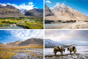
[[File:Landscapes of Qumi.png|thumb|left|Landscapes of Qumi]] | |||
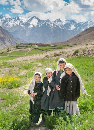
[[File:Qumi children.png|thumb|left|Qumi children from a village located in the [[Hare Krishna]] mountains]] | [[File:Qumi children.png|thumb|left|Qumi children from a village located in the [[Hare Krishna]] mountains]] | ||
At {{convert|19,484|km2|sqmi|abbr=on}}, Qumi Governorate ranks as the 19th largest governorate of Gandhara, and it has the second-smallest population, only having approximately 2,000 inhabitants more that the least populated [[Dabbagh Governorate]]. Covered with the [[Hare Krishna]] mountain range, the entire governorate is at a high altitude: the lowest point is at {{convert|2,902|m|ft|abbr=on}} and 99,9% of the governorate is above {{convert|3,000|m|ft|abbr=on}}. | At {{convert|19,484|km2|sqmi|abbr=on}}, Qumi Governorate ranks as the 19th largest governorate of Gandhara, and it has the second-smallest population, only having approximately 2,000 inhabitants more that the least populated [[Dabbagh Governorate]]. Covered with the [[Hare Krishna]] mountain range, the entire governorate is at a high altitude: the lowest point is at {{convert|2,902|m|ft|abbr=on}} and 99,9% of the governorate is above {{convert|3,000|m|ft|abbr=on}}. | ||
Revision as of 22:25, 10 March 2018
| Qumi Governorate محافظة القمي | |||
|---|---|---|---|
| Governorate of Gandhara | |||
| |||
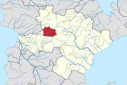
 Location of Qumi in Gandhara | |||
| Country | |||
| Capital | Tabatabaei | ||
| Government | |||
| • Governor | Elias al-Zahrawi | ||
| Area | |||
| • Total | 19,484 km2 (7,523 sq mi) | ||
| Population (2016) | |||
| • Total | 103,724 | ||
| • Density | 5.3/km2 (14/sq mi) | ||
Qumi Governorate (Arabic: محافظة القمي Muḥāfaẓah al-Qumi) is a governorate of Gandhara, located in the western part of the country. In 2016, the governorate had a population of 103,724 and a total area of 19,484 km2 (7,523 sq mi). Tabatabaei serves as its capital. The governorate is largely mountainous and contains Outernatia's highest point, Mount Taysir, at 5,769 m (18,927 ft).
History
The area that is now known as the Qumi Governorate has been inhabited for thousands of years. It is known that the Qumi people were inhabiting the mountainous region north of Rhea already in the 9th century, as the Arab traveler Al-Masudi speaks of them.
The territory was under the rule of the Mongol Empire between 1246 and 1295, after which it became independent as the Qumi Khanate. From 1557, it became a protectorate of the expanding Gandhari Empire. After the collapse of the Gandhari Empire, the area became part of the State of Gandhara. Due to its mountainous character and low population, the area remained relatively untouched during the Gandhari Revolution.
Geography


At 19,484 km2 (7,523 sq mi), Qumi Governorate ranks as the 19th largest governorate of Gandhara, and it has the second-smallest population, only having approximately 2,000 inhabitants more that the least populated Dabbagh Governorate. Covered with the Hare Krishna mountain range, the entire governorate is at a high altitude: the lowest point is at 2,902 m (9,521 ft) and 99,9% of the governorate is above 3,000 m (9,800 ft).
Qumi lies south of the region Gandhari Kurdistan. It borders Khani in the north, Dabbagh in the east, Kirmani and Sadat in the south, and Badawi in the west.

