
Aonach: Difference between revisions
No edit summary |
No edit summary |
||
| Line 109: | Line 109: | ||
Most of Aonach has a [[wikipedia:temperate|temperate seasonal climate]] in which humid northerly winds predominate. The climate is moderated by the Southern Ocean Drift. This warmer water affects the areas bordering the Sea; consequently in the south the climate is [[wikipedia:oceanic climate|oceanic]]. Tikata gets an average of {{convert|721|mm|0|abbr=on}} [[wikipedia:Precipitation (meteorology)|precipitation]] per year. Rainfall occurs year-round, with no obligatory dry season. Winters are mild and summers tend to be warm, temperatures can exceed {{convert|20|°C|°F|lk=on}}. | Most of Aonach has a [[wikipedia:temperate|temperate seasonal climate]] in which humid northerly winds predominate. The climate is moderated by the Southern Ocean Drift. This warmer water affects the areas bordering the Sea; consequently in the south the climate is [[wikipedia:oceanic climate|oceanic]]. Tikata gets an average of {{convert|721|mm|0|abbr=on}} [[wikipedia:Precipitation (meteorology)|precipitation]] per year. Rainfall occurs year-round, with no obligatory dry season. Winters are mild and summers tend to be warm, temperatures can exceed {{convert|20|°C|°F|lk=on}}. | ||
The north has a more [[wikipedia:continental climate]]; winters can be very cold and summers very warm, and longer dry periods can occur. Central Aonach is a transition regions which vary from moderately oceanic to continental. | The north has a more [[wikipedia:continental|continental climate]]; winters can be very cold and summers very warm, and longer dry periods can occur. Central Aonach is a transition regions which vary from moderately oceanic to continental. | ||
== | ==Administrative divisions== | ||
Aonach comprises of four states. Each state has its own state constitution and is largely autonomous in regard to its internal organization. | Aonach comprises of four states. Each state has its own state constitution and is largely autonomous in regard to its internal organization. | ||
===Constituent states=== | |||
{{States of Aonach}} | {{States of Aonach}} | ||
Revision as of 21:42, 21 November 2013
| Democratic Republic of Aonach Aonach | |
|---|---|
 Flag | |
 Location of Aonach in Internatia. | |
| Capital and largest city | Láirge |
| Official languages | Aonachian, French and English |
| Demonym | Aonachian |
| Government | Constitutional Democracy |
| Republic Formed 20th century (1992) | |
| Area | |
• Total | 450,217 km2 (173,830 sq mi) |
| Population | |
• 2013 estimate | 14,514,670 |
• Density | 32.29/km2 (83.6/sq mi) |
| Currency | Schilling (AOS) |
| Time zone | FIT (UTC+3:00) |
| Date format | DD/MM/YY |
| Drives on the | left |
| Calling code | 57 |
| Internet TLD | .ac |
Aonach, officially the Democratic Republic of Aonach, is a sovereign nation in South Internatia. Its mainland is bordered to the North and East by DPR Jindalea, to the West by Canedonia and to the South by the Southern Ocean. It also completely surrounds the nation of Swelatie.
Aonach is the seventh-largest in Internatia as a whole. With a total population of around 14 million, it is the eighteenth most-populous country in Internatia, and one of the least densely populated nations in Internatia. Aonach is a constitutional democracy organized in the form of a parliamentary republic with its capital in Láirge, the nation's largest city and the main cultural and commercial center .
Aonachian citizens enjoy a high standard of living, with the country performing well in international rankings of education, health care, life expectancy, civil liberties, and human development.
Etymology
The name 'Aonach' comes from the Irish word of the same meaning, which is 'marketplace'. The origins of this name are thought to be linked to the formation of a market town on the river Gabhann in the 12th century. As this river exits Internatia through Aonach, it was thought to be a vital trading port for settlers in this area. The city of Láirge was developed in this very site.
Geography
Aonach is a mountainous nation, with the highest peak being Mont Cnoc, located in the state of Átha, in the north of the nation. The height of this peak is 5486 ft or 1672.13 m. This peak is located in the Chaîne Sléibhte, both the highest and longest range in the nation of Aonach.
There are three major rivers located in the nation, and two of these are considered vital rivers in the southern region of Internatia. Both of these exit Internatia through Aonach (specifically Béál) and into the Southern Ocean, and are therefore crucial to the Aonachian economy. The longest river is the Gabhann river, which Láirge is built on. The length of the river is 512 km.
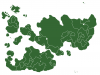
As can be seen from the map, Átha lacks a major river in it's territory and as a result of the mountainous terrain and small size, it is the most sparsely populated state in Aonach.
As previously mentioned, the nation shares its borders to the North and East with DPR Jindalea and with Canedonia to the west. It completely surrounds, and indeed landlocks the nation of LM Lazovi. Both nations share common cultural and linguistic ties, as well as a close political relationship.
Climate
Most of Aonach has a temperate seasonal climate in which humid northerly winds predominate. The climate is moderated by the Southern Ocean Drift. This warmer water affects the areas bordering the Sea; consequently in the south the climate is oceanic. Tikata gets an average of 721 mm (28 in) precipitation per year. Rainfall occurs year-round, with no obligatory dry season. Winters are mild and summers tend to be warm, temperatures can exceed 20 °C (68 °F).
The north has a more continental climate; winters can be very cold and summers very warm, and longer dry periods can occur. Central Aonach is a transition regions which vary from moderately oceanic to continental.
Administrative divisions
Aonach comprises of four states. Each state has its own state constitution and is largely autonomous in regard to its internal organization.
Constituent states
| Flag | State | Area (km²) | Population | Pop. per km² |
Capital | |
|---|---|---|---|---|---|---|
| Árann | 142,100 | 4,450,000 | 31.35 | Saint-Germain | ||
| Átha | 60,207 | 850,000 | 14.12 | Gheimhridh | ||
| Béal | 171,250 | 7,500,000 | 43.79 | Láirge | ||
| Géan | 76,800 | 1,750,000 | 22.79 | Billancourt | ||

Demographics
Largest cities or towns in Aonach
Aonach National Census 2012 | |||||||||
|---|---|---|---|---|---|---|---|---|---|
| Rank | State | Pop. | |||||||
| Láirge Láirge Saint-Germain Saint-Germain |
1 | Láirge | Béal | 3,502,010 | Samhraidh Samhraidh Nouvelle-Ville Nouvelle-Ville | ||||
| 2 | Saint-Germain | Árann | 2,001,049 | ||||||
| 3 | Samhraidh | Béal | 1,987,690 | ||||||
| 4 | Nouvelle-Ville | Árann | 1,567,234 | ||||||
| 5 | Cote d’Or | Béal | 1,312,400 | ||||||
| 6 | Teampall Mór | Béal | 1,091,000 | ||||||
| 7 | Billancourt | Géan | 985,710 | ||||||
| 8 | Gheimhridh | Átha | 521,789 | ||||||
| 9 | Samhraidh | Géan | 418,934 | ||||||
| 10 | Eanair | Árann | 371,124 | ||||||
| Sovereign states |
|  |
|---|---|---|
| Extracontinental states | ||
| Other states | ||
| Former states |
| |