
List of sovereign states in Outernatia: Difference between revisions
Juan Lechuga (talk | contribs) Created page with "<center> <div class="thumbinner"><div class="overflowbugx" style="overflow: auto;"> <small>Clickable map of Outernatia </small> <center> {{Outernatia Labelled Map}} </center>..." |
Juan Lechuga (talk | contribs) |
||
| Line 10: | Line 10: | ||
==Current states== | ==Current states== | ||
{| class="wikitable sortable" style="width:100%" | |||
! class="unsortable" | Flag | |||
! class="unsortable" | Map | |||
! English short name | |||
! English formal name | |||
! Capital | |||
! Population | |||
! Area | |||
|- | |||
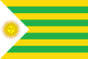
| [[File:Flag of Lettuce.png|border|centre|100px|link=Flag of Lettuce|alt=Flag of Lettuce]] | |||
| [[File:Extracontinental-Lettuce.png|border|centre|150px|alt=Map showing Lettuce]] | |||
| [[Lettuce]] | |||
| Bolivarian Republic of Lettuce | |||
| [[Hugo Chávez City]] | |||
| 5,232,456 | |||
| {{sort|00030054|{{convert|30054|km2|sqmi|0|abbr=on}}}} | |||
|- | |||
| [[File:Flag of San Remo.png|border|centre|100px|link=Flag of San Remo|alt=Flag of San Remo]] | |||
| [[File:Extracontinental-San_Remo.png|border|centre|150px|alt=Map showing San Remo]] | |||
| [[San Remo]] | |||
| San Remo | |||
| [[Rhea]] | |||
| 10,267,340 | |||
| {{sort|00495807|{{convert|495807|km2|sqmi|0|abbr=on}}}} | |||
|} | |||
===Dependent territories=== | |||
{| class="wikitable sortable" style="width:100%" | |||
! class="unsortable" | Flag | |||
! class="unsortable" | Map | |||
! English short name | |||
! English formal name | |||
! Capital | |||
! Population | |||
! Area | |||
|- | |||
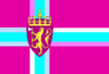
| [[File:Flag of Roseau (St Olaf).png|border|centre|100px|link=Flag of Roseau|alt=Flag of Roseau]] | |||
| [[File:Extracontinental-Roseau.png|border|centre|150px|alt=Map showing Roseau]] | |||
| [[Roseau]] | |||
| Roseau | |||
| Keljda | |||
| 393,514 | |||
| {{sort|00006876|{{convert|6876|km2|sqmi|0|abbr=on}}}} | |||
|- | |||
| [[File:Flag of St Gustav.png|border|centre|100px|link=Flag of St Gustav|alt=Flag of St Gustav]] | |||
| [[File:Extracontinental-St_Gustav.png|border|centre|150px|alt=Map showing St Gustav]] | |||
| [[St Gustav]] | |||
| St Gustav | |||
| Toboggan | |||
| 1,034,397 | |||
| {{sort|00013487|{{convert|13487|km2|sqmi|0|abbr=on}}}} | |||
|} | |||
Revision as of 18:55, 22 October 2014

Current states
| Flag | Map | English short name | English formal name | Capital | Population | Area |
|---|---|---|---|---|---|---|
 |
 |
Lettuce | Bolivarian Republic of Lettuce | Hugo Chávez City | 5,232,456 | 30,054 km2 (11,604 sq mi) |
 |
 |
San Remo | San Remo | Rhea | 10,267,340 | 495,807 km2 (191,432 sq mi) |
Dependent territories
| Flag | Map | English short name | English formal name | Capital | Population | Area |
|---|---|---|---|---|---|---|
 |
 |
Roseau | Roseau | Keljda | 393,514 | 6,876 km2 (2,655 sq mi) |
 |
 |
St Gustav | St Gustav | Toboggan | 1,034,397 | 13,487 km2 (5,207 sq mi) |