
File:Tikata location map with disonia.png: Difference between revisions
No edit summary |
No edit summary |
||
| Line 1: | Line 1: | ||
== Summary == | |||
{{Information | |||
|Description=Location map of the Tikata (with claimed Disonia). | |||
|Date= | |||
|Source={{own}} | |||
|Author=santos | |||
|other_versions = | |||
<gallery> | |||
File:Tikata location map.png|Main location map | |||
File:Tikata counties.png|Political map with states and counties | |||
</gallery> | |||
}} | |||
[[Category:Location maps]] | |||
[[Category:Location maps of Tikata]] | |||
Revision as of 13:52, 11 February 2015
Summary
| Description |
Location map of the Tikata (with claimed Disonia). |
|---|---|
| Source |
Own work |
| Date | |
| Author |
santos |
| Permission (Reusing this file) |
See below. |
| Other versions |
|


File history
Click on a date/time to view the file as it appeared at that time.
| Date/Time | Thumbnail | Dimensions | User | Comment | |
|---|---|---|---|---|---|
| current | 21:50, 9 February 2015 | 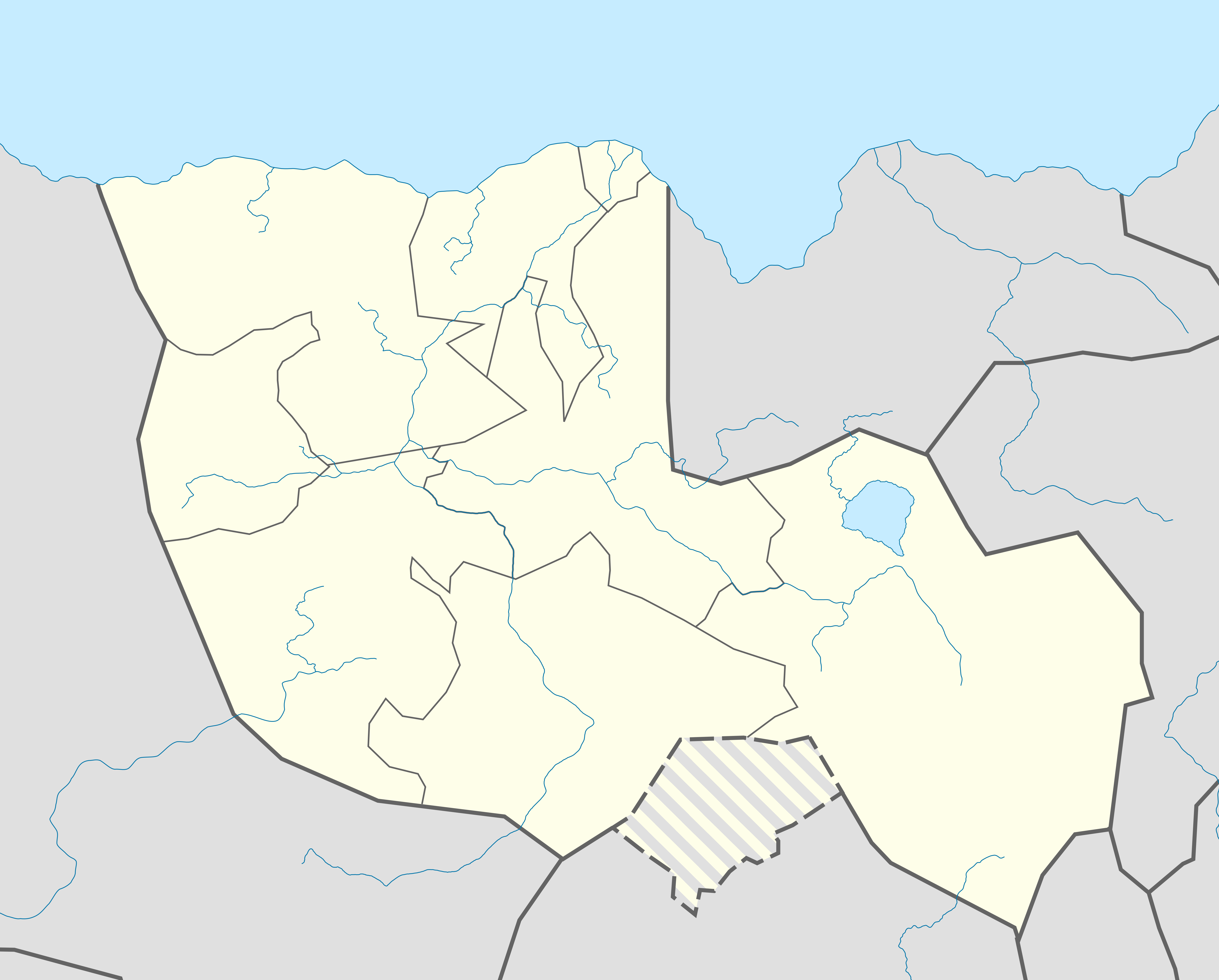 | 7,500 × 6,031 (1.63 MB) | Santos (talk | contribs) |
You cannot overwrite this file.
File usage
The following page uses this file: