Extreme points of Outernatia: Difference between revisions
Jump to navigation
Jump to search
No edit summary |
No edit summary |
||
| Line 2: | Line 2: | ||
==Extreme points== | ==Extreme points== | ||
{{Location mark+ | |||
| image = Outernatia location map.png | |||
| width = 350 | |||
| float = right | |||
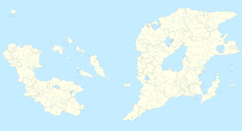
| caption = Extreme points of Outernatia. | |||
| type = thumb | |||
| marks = | |||
{{Location mark~ | |||
| width = 350 | |||
| label = '''Kimmystan''' | |||
| position = right | |||
| background = | |||
| mark = Red pog.svg | |||
| x = 778 | y = 29 }} | |||
{{Location mark~ | |||
| width = 350 | |||
| label = '''Easterosia''' | |||
| position = left | |||
| background = | |||
| mark = Red pog.svg | |||
| x = 994 | y = 213 }} | |||
{{Location mark~ | |||
| width = 350 | |||
| label = '''Aurävaan''' | |||
| position = right | |||
| background = | |||
| mark = Red pog.svg | |||
| x = 8 | y = 219 }} | |||
{{Location mark~ | |||
| width = 350 | |||
| label = '''EdvinOla''' | |||
| position = right | |||
| background = | |||
| mark = Red pog.svg | |||
| x = 531 | y = 501 }} | |||
{{Location mark~ | |||
| width = 350 | |||
| label = '''Mount<br>Taysir''' | |||
| position = right | |||
| background = | |||
| mark = Red triangle with thick white border.svg.png | |||
| x = 626 | y = 217 }} | |||
}} | |||
*'''Northernmost point'''. [[Kimmystan]] (19°22′42.712″N 142°12′10.548″E). | *'''Northernmost point'''. [[Kimmystan]] (19°22′42.712″N 142°12′10.548″E). | ||
*'''Southernmost point'''. [[EdvinOla]] (21°58′38.644″S 123°38′46.424″E). | *'''Southernmost point'''. [[EdvinOla]] (21°58′38.644″S 123°38′46.424″E). | ||
Revision as of 19:35, 28 August 2016
This is a list of the extreme points of Outernatia: the geographical points that are higher or farther north, south, east or west than any other location in Outernatia.
Extreme points
- Northernmost point. Kimmystan (19°22′42.712″N 142°12′10.548″E).
- Southernmost point. EdvinOla (21°58′38.644″S 123°38′46.424″E).
- Westernmost point. Easterosia (3°13′13.220″N 158°24′56.256″E).
- Easternmost point. Aurävaan (2°39′19.322″N 84°5′28.161″E).
Elevation

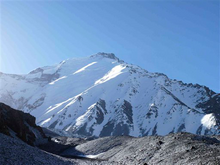
- Highest point. Mount Taysir, Gandhara (5,769 metres; 18,927 feet).
