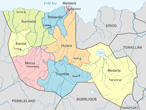
Template:States of Tikata: Difference between revisions
Jump to navigation
Jump to search
No edit summary |
No edit summary |
||
| Line 24: | Line 24: | ||
{{clear}} | {{clear}} | ||
<noinclude> | |||
[[Category:Maps of Germany]] | |||
[[Category:States of Tikata templates| ]] | [[Category:States of Tikata templates| ]] | ||
</noinclude> | </noinclude> | ||
Revision as of 19:45, 18 July 2017
| Flag | State | Capital | Population | Area | Density |
|---|---|---|---|---|---|
| Hulara | Avrio | 5,137,149 | 79,909 km2 | 64.29 | |
| Madakia | Madakia | 4,397,449 | 3,863 km2 | 1,138.35 | |
| Medaria | Tramandi | 5,846,748 | 147,110 km2 | 39.74 | |
| Morsa | Viretunata | 7,145,667 | 77,762 km2 | 91.89 | |
| Roberdio | Livinera | 3,952,988 | 32,679 km2 | 120.96 | |
| File:Flag of Surmetia.png | Surmetia | Surme | 11,023,558 | 85,388 km2 | 129.10 |
| Trumbia | Zixan | 8,349,554 | 81,841 km2 | 102,02 | |
| Xanita | Turzy | 10,218,789 | 33,764 km2 | 302.65 |
