Araz Airport: Difference between revisions
Jump to navigation
Jump to search
mNo edit summary |
No edit summary |
||
| Line 44: | Line 44: | ||
| elevation-m = 1,213 | | elevation-m = 1,213 | ||
| metric-elev = | | metric-elev = | ||
| coordinates = {{coord| | | coordinates = {{coord|4.34|133.32}} | ||
| website = <!-- {{URL|example.com}} --> | | website = <!-- {{URL|example.com}} --> | ||
| image_map = | | image_map = | ||
Latest revision as of 23:22, 16 March 2018
| Araz Airport مطار ال اراز Maṭār al-Araz | |||||||||||||||
|---|---|---|---|---|---|---|---|---|---|---|---|---|---|---|---|
 | |||||||||||||||
| Summary | |||||||||||||||
| Airport type | Public | ||||||||||||||
| Owner/Operator | AA Holding S.M.M. | ||||||||||||||
| Serves | Araz, Gandhara | ||||||||||||||
| Location | Araz | ||||||||||||||
| Focus city for | Air Nura | ||||||||||||||
| Elevation AMSL | 3,980 ft / 1,213 m | ||||||||||||||
| Map | |||||||||||||||
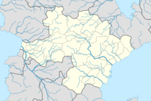
| Location within Gandhara | |||||||||||||||
| Runways | |||||||||||||||
| |||||||||||||||
| Helipads | |||||||||||||||
| |||||||||||||||
| Statistics (2016) | |||||||||||||||
| |||||||||||||||
Araz Airport (Arabic: مطار ال اراز; Maṭār al-Araz) (IATA: ARA, ICAO: OGAZ) is an international airport located 17 km (11 mi) southeast of Araz, in the Kurdistan Region of Gandhara.

