Irdminia
| Liberal Democracy of Irdminia Liiberl Deemocrativi e Irdminght | |
|---|---|
Motto: "Ry ast pthar wer hamgeen y cthivilli mimz ükselfn" "You're born to live and fight it all the way" | |
 Location of Irdminia in Internatia | |
| Capital and largest city | Sakgthatöön |
| Official languages | Irdmish, English |
| Ethnic groups | 93.7% Irdminian 4.6% Volnytarian 1.7% Others |
| Demonym | Irdminian |
| Government | Unitary presidential constitutional republic |
• President | Bthar Uvntand |
| Independence | |
• Foundation Date & Recognition | May 14, 1792 |
| Area | |
• Total | 103,327 km2 (39,895 sq mi) |
• Water (%) | 4.72 |
| Population | |
• 2012 estimate | 2,193,689 |
• Density | 21.23/km2 (55.0/sq mi) |
| GDP (nominal) | 2012 estimate |
• Total | $91.653 billion |
• Per capita | $41.780 |
| HDI (2012) | Error: Invalid HDI value |
| Currency | Idt (Ǐ) (IDT) |
| Time zone | Central Internatia Time (CIT) (UTC+1) |
| Calling code | +177 |
| Internet TLD | .II |
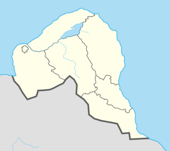
Irdminia officially the Liberal Democracy of Irdminia (Irdmish: Liiberl Deemocrativi e Irdminght) is a country in North-West Internatia on the Maurocephalon Peninsula. It's bordered by Sea of Aragon to the north and west, by Big Gileste Bay to the east and by Volnytaria to the south. It is devided into 6 regions and one individual city of Sakgthatöön.
As of 2012, the population of Irdminia was 2,193,689, of which 674,560 live in Sakgthatöön, the country's capital and the largest city located in the west, and 111,269 in Arminvik, the second-largest city, located in the other side of the country, east, which is also known for its best universities in country. It is a developed country, with one of the highest GDP per capita and Human Development Index (HDI), mainly because of the huge oil reserves located on the Sea of Aragon, to the north of the Öö city.
Etymology
Irdminia most probably derives from the tribe of Irds, which used to live high in the mountains, next to the Kohvulaan peak. It first appears on the two runestones found in Jembch Cave, where the name "Ird" or "Irght" was mentioned.
Geography
Climate
Irdminia lies in the northern part of the temperate climate zone, mainly in the maritime climate. In most inhabited regions of Irdminia, at lower altitudes, the weather is generally moderate. In highest parts, especially in Uuku region, average temperatures are lower, and snow cover lasts longer - around Kohvulaan mountain it stays for almost all year.
The average annual temperature in Irdminia is 4.2 °C (39.56 °F). The average temperature in February, the coldest month of the year, is −6.0 °C (21.2 °F). The average temperature in July, which is considered the warmest month of the year, is 16.9 °C (62.42 °F).
Administrative divisions
Irdminia is divided on 6 regions, called Dwemz, and one individual city of Sakgthatöön.

| Flag | State | Capital | Population |
|---|---|---|---|
| Skyrim | Skyrim | 674,560 | |
| Avnsartu | Öö | 212,041 | |
| Kagnveel | Kag Renzel | 318,102 | |
| Pivikki | Arminvik | 355,238 | |
| Uuku | Mzelft | 162,624 | |
| Vaghnthan | Nchunz | 263,840 | |
| Znchis | Rakvaarja | 207,284 |
Largest Cities
Sakgthatöön, the capital of Irdminia is also its biggest, and most important city, located in the western coast. It is followed by an Arminvik on the west, which is named the cultural and educational capital of the country.
Largest cities or towns in Irdminia
Irdminian National Census 2012 | |||||||||
|---|---|---|---|---|---|---|---|---|---|
| Rank | Region | Pop. | |||||||
 Skyrim  Arminvik |
1 | Skyrim | Skyrim | 674,560 |  Kag Renzel  Öö | ||||
| 2 | Arminvik | Pivikki | 111,269 | ||||||
| 3 | Kag Renzel | Kagnveel | 102,624 | ||||||
| 4 | Öö | Avnsartu | 86,149 | ||||||
| 5 | Nchunz | Vaghnthan | 72,657 | ||||||
| 6 | Mzelft | Uuku | 66,931 | ||||||
| 7 | Rakvaarja | Znchis | 55,177 | ||||||
| 8 | Määrcinn | Vaghnthan | 48,692 | ||||||
| 9 | Estikato | Pivikki | 43,129 | ||||||
| 10 | Ohahaght ek Avnsartu | Avnsartu | 39,022 | ||||||

