|
|
| (16 intermediate revisions by 2 users not shown) |
| Line 1: |
Line 1: |
| {{Infobox country | | {{Infobox country |
| |native_name = República de San Remo <small>([[Wikipedia:Spanish_language|Spanish]])</small> <br> República de Sanremo <small>([[Wikipedia:Portuguese_language|Portuguese]])</small> | | |native_name = |
| |conventional_long_name = Republic of San Remo | | |conventional_long_name = San Remo |
| |common_name = San Remo | | |common_name = San Remo |
| |image_flag = Flag of San Remo.png | | |image_flag = Flag of San Remo.png |
| |image_coat = Coat of arms of San Remo.png | | |image_coat = Coat of arms of San Remo.png |
| |symbol_type = Coat of arms | | |symbol_type = Coat of arms |
| |national_motto = "Deus lo vult" (Latin) <br><small>''God wants it''</small> | | |national_motto = "Deus lo vult" ([[Wikipedia:Latin_language|Latin]])<br><small>''God wants it''</small> |
| |national_anthem = | | |national_anthem = |
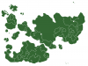
| |image_map = Internatia-San_Remo.png | | |image_map = Location San Remo.png |
| |map_caption = Location of San Remo | | |image_map2 = Archipelago San Remo.png |
| | |map_caption = Location of '''San Remo''' (orange) |
| | |map_caption2 = '''San Remo''' (orange) |
| |capital = [[Rhea]] | | |capital = [[Rhea]] |
| |largest_city = capital | | |largest_city = capital |
| |official_languages = [[Wikipedia:Spanish_language|Spanish]], [[Wikipedia:Portuguese_language|Portuguese]], [[Wikipedia:Latin|Latin]] | | |official_languages = [[Romi]], [[Tikatan]] |
| |national_languages = | | |national_languages = |
| |demonym = San Remano/a | | |demonym = San Reman |
| |government_type = [[Wikipedia:Unitary_state|Unitary]] [[Wikipedia:Presidential_system|presidential]] [[Wikipedia:Constitutional_republic|constitutional republic]] | | |government_type = [[Wikipedia:Unitary_state|Unitary]] [[Wikipedia:Parliamentary_system|parliamentary]] [[Wikipedia:Constitutional_monarchy|constitutional monarchy]] |
| |leader_title1 = President | | |leader_title1 = Monarch |
| |leader_name1 = Juan García Aragón | | |leader_name1 = [[Michael_II_of_Tikata|Michael II]] |
| |leader_title2 = Vice President | | |leader_title2 = Governor-General |
| |leader_name2 = Horacio Domingo Elizondo | | |leader_name2 = Horacio Domingo Elizondo |
| | |leader_title3 = Prime Minister |
| | |leader_name3 = Juan García Aragón |
| |sovereignty_type = | | |sovereignty_type = |
| |established_event1 = Unification | | |established_event1 = |
| |established_date1 = 1513 | | |established_date1 = |
| |established_event2 = Treaty of Astrée | | |established_event2 = |
| |established_date2 = 1703 | | |established_date2 = |
| |established_event3 = Republic | | |established_event3 = |
| |established_date3 = 1889 | | |established_date3 = |
| |established_event4 = | | |established_event4 = |
| |established_date4 = | | |established_date4 = |
| Line 32: |
Line 36: |
| |established_date9 = | | |established_date9 = |
| |area = <!-- major area size (in [[Template:convert]] either km2 or sqmi first) --> | | |area = <!-- major area size (in [[Template:convert]] either km2 or sqmi first) --> |
| |area_km2 = <!-- major area size (in square km) --> 111296 | | |area_km2 = 495807 |
| |area_sq_mi = <!-- area in square mi (requires area_km2) --> | | |area_sq_mi = <!-- area in square mi (requires area_km2) --> |
| |population_estimate = 10,267,340 | | |area_label = Total |
| | |population_estimate = 50,371,809 |
| |population_estimate_rank = | | |population_estimate_rank = |
| |population_estimate_year = 2013 | | |population_estimate_year = 2014 |
| |population_census = | | |population_census = |
| |population_census_year = | | |population_census_year = |
| |population_density_km2 = 92.3 | | |population_density_km2 = 101.60 |
| |population_density_sq_mi = | | |population_density_sq_mi = |
| |GDP_PPP = | | |GDP_PPP = |
| |GDP_PPP_rank = | | |GDP_PPP_rank = |
| Line 55: |
Line 60: |
| |HDI_category = | | |HDI_category = |
| |currency = [[Aleta]] | | |currency = [[Aleta]] |
| |currency_code = COP | | |currency_code = SRA |
| |time_zone = | | |time_zone = |
| |utc_offset = | | |utc_offset = |
| Line 67: |
Line 72: |
| |}} | | |}} |
|
| |
|
| '''San Remo''', officially the '''Republic of San Remo''', is a sovereign state, located on the northern continent of Internatia. The capital is [[Rhea]], the largest city of the country by both land area and population. San Remo is bordered by [[Sockistan]] to the northwest, [[Anselmsuusonia]] to the east, [[Kosma]] to the southeast and by the sea to the north and the southwest.<br> | | '''San Remo''' ([[Romi]]: ''Sanremo'', [[Tikatan]]: ''Sant'xa Remarz'') is an [[Wikipedia:Island_country|island country]]. The country geographically comprises two main landmasses and several smaller islands. |
|
| |
|
| A small region in the west of San Remo, at the border with Sockistan, is under the [[Wikipedia:De_facto|de facto]] control of the breakaway government of [[Colinestria]] since 1 September 2013. | | San Remo gained independence from the [[Tikata|Kingdom of Tikata]] in 1814. A new [[Wikipedia:Constitution|constitution]] was adopted on 6 January 1815. The western part of Carbalia, the second largest island of San Remo, has been under the ''[[Wikipedia:De_facto|de facto]]'' control of the breakaway government of [[Colinestria]] since 1 September 2013. |
|
| |
|
| The country is a [[Wikipedia:Unitary_state|unitary]] [[Wikipedia:Presidential_system|presidential]] [[Wikipedia:Constitutional_republic|constitutional republic]] with a president as [[Wikipedia:Head_of_state|head of state]] and [[Wikipedia:Head_of_government|head of government]].
| | Nationally, legislative authority is vested in an elected, unicameral parliament, while executive political power is exercised by the cabinet, led by the [[Wikipedia:Prime_minister|Prime Minister]], who is currently Juan García Aragón. King [[Michael_II_of_Tikata|Michael II]] is the country's head of state and is represented by a [[Wikipedia:Governor-General|Governor-General]]. In addition, San Remo is organised into 15 regional councils and 67 provinces for local government purposes. San Remo is a member of the [[Commonwealth of Nations]]. |
|
| |
|
| == History ==
| | {{Countries of Internatia |state=collapsed}} |
| | | [[Category:Country]] |
| ===Pre-San Remo===
| |
| | |
| San Remo was already inhabited in 10,000 BC. It was a part of the [[Wikipedia:Roman_Empire|Roman Empire]] during the [[Wikipedia:Ancient_Rome|ancient Roman civilization]] and it existed of different kingdoms during the [[Wikipedia:Middle_Ages|Middle Ages]]. An important city was San Remo, founded on [[Wikipedia:August_13|13 August]] [[Wikipedia:489|489]] and named after [[Wikipedia:St._Remigius|St. Remigius]].
| |
| | |
| ===The unification===
| |
| | |
| The first signs of a unified San Remo appeared at the beginning of the [[Wikipedia:16th_century|16th century]] when different writers wrote about the unification of the different kingdoms. Amadora and Astralia were already unified in the Kingdom of Astralia and Amadora (''Reino de Astralia e Amadora'') after the marriage of the Astralian [[Wikipedia:Princess|princess]] Maria with the Amadoran [[Wikipedia:Prince|prince]] Pierro in [[Wikipedia:1446|1446]].
| |
| | |
| The Kingdom of León (''Reino de León'') had financial problems since the late [[Wikipedia:15th_century|15th century]] and the kingdom joined the Kingdom of Astralia and Amadora with the Treaty of San Remo in [[Wikipedia:1513|1513]]. It was the beginning of the United Kingdoms of San Remo ([[Wikipedia:Spanish_language|Spanish]]: ''Reinos Unidos de San Remo'', [[Wikipedia:Portuguese_language|Portuguese]]: ''Reinos Unidos de Sanremo''), a [[Wikipedia:Dual_monarchy|dual monarchy]] with the city of San Remo (also spelled as ''Sanremo'' since the [[Wikipedia:Late_Middle_Ages|Late Middle Ages]]) as [[Wikipedia:Capital_city|capital]].
| |
| | |
| In [[Wikipedia:1650|1650]] the king of San Remo decided to move to Rhea, an important city for [[Wikipedia:Culture|culture]], [[Wikipedia:art|art]] and for the [[Wikipedia:economy|economy]], and Rhea became the new capital of San Remo.
| |
| | |
| ===The holy war===
| |
| | |
| In [[Wikipedia:1668|1668]] Sockistan occupied Casundra, an independent region with monasteries, in order to conquer the area and to add it to the Sockistan empire. The king of San Remo decided to protect the area. It was the beginning of The holy war (''La guerra santa'') which lasted for 35 years. The war ended in [[Wikipedia:1703|1703]] with the Treaty of Astrée. By this treaty the countries Sockistan and San Remo agreed that Casundra and the northern areas, which were ruled by Sockistan since the [[Wikipedia:15th_century|15th century]], became a part of the kingdom of San Remo, giving the country access to the Suusonia Bay. The historical region Colinestria, a part of Astralia since the [[Wikipedia:14th_century|14th century]], became a part of Sockistan in return. Because of the expansion of San Remo, the kingdom was no longer a dual monarchy and therefore the name was changed from the United Kingdoms of San Remo into the Kingdom of San Remo ([[Wikipedia:Spanish_language|Spanish]]: ''Reino de San Remo''; [[Wikipedia:Portuguese_language|Portuguese]]: ''Reino de Sanremo'').
| |
| | |
| ===The Treaty of Medea===
| |
| | |
| The relationship between San Remo and Sockistan remained tense during the [[Wikipedia:18th_century|18th century]]. Sockistan lost access to the Suusonia Bay by the Treaty of Astrée, while San Remo lost Colinestria, an important area with a wide array of mineral resources which include natural gas, coal, bauxite, tantalite, gold, tin, iron ore, limestone, niobium, lead and zinc.
| |
| | |
| After a long period of negotiations, both countries agreed on [[Wikipedia:February_19|19 February]] [[Wikipedia:1785|1785]] in The Treaty of Medea that the most northern part of San Remo became a part of Sockistan again and that Colinstria became a part of San Remo in return, giving San Remo its current official land borders.
| |
| | |
| ===From a kingdom to a republic===
| |
| | |
| In [[Wikipedia:1889|1889]] king Ferdinand II of San Remo abdicated the throne and San Remo became a [[Wikipedia:Republic|republic]] on [[Wikipedia:July_5|5 July]] [[Wikipedia:1889|1889]].
| |
| | |
| == Government ==
| |
| | |
| ===Administrative divisions===
| |
| | |
| San Remo is divided into 13 departments ([[Wikipedia:Spanish language|Spanish]]: ''departamentos'', sing. ''[[Wikipedia:Departamento|departamento]]''). San Remo is a [[Wikipedia:Unitary_state|unitary]] [[Wikipedia:Presidential_system|presidential]] [[Wikipedia:Constitutional_republic|constitutional republic]], but the departments are autonomous after the central government delegated political powers through [[Wikipedia:Devolution|devolution]] to the local governments of the departments by [[Wikipedia:Statute_of_Autonomy|statute]].
| |
| | |
| {{San Remo Labelled Map|float=left}} | |
| | |
| {| class="sortable wikitable" style="text-align:left; width:30%; float:right;"
| |
| |-
| |
| ! style="width:25px"| Flag
| |
| ! Name
| |
| ! Capital
| |
| |-
| |
| |[[File:AlmeidaFlag.png|border|30px]]
| |
| |Almeida
| |
| |Vila Nova
| |
| |-
| |
| |[[File:AmadoraFlag.png|border|30px]]
| |
| |Amadora
| |
| |Sanremo (San Remo)
| |
| |-
| |
| |[[File:AstraliaFlag.png|border|30px]]
| |
| |Astralia
| |
| |Santo António
| |
| |-
| |
| |[[File:BoyacáFlag.png|border|30px]]
| |
| |Boyacá
| |
| |Florencia
| |
| |-
| |
| |[[File:CasundraFlag.png|border|30px]]
| |
| |Casundra
| |
| |Medea
| |
| |-
| |
| |[[File:CosmaFlag.png|border|30px]]
| |
| |Cosma del Oeste
| |
| |Agustín
| |
| |-
| |
| |[[File:GondomarFlag.png|border|30px]]
| |
| |Gondomar
| |
| |Vila Franca
| |
| |-
| |
| |[[File:LeónFlag.png|border|30px]]
| |
| |León
| |
| |[[Rhea]]
| |
| |-
| |
| |[[File:MagdalenaFlag.png|border|30px]]
| |
| |Magdalena
| |
| |Guelaya
| |
| |-
| |
| |[[File:MontanaFlag.png|border|30px]]
| |
| |Montana
| |
| |Zanzibar
| |
| |-
| |
| |[[File:MontoyáFlag.png|border|30px]]
| |
| |Montoyá
| |
| |Atlántico
| |
| |-
| |
| |[[File:PenedesFlag.png|border|30px]]
| |
| |Penedés
| |
| |Las Cabanas
| |
| |-
| |
| |[[File:SoniaFlag.png|border|30px]]
| |
| |Sonia
| |
| |San Alfonso
| |
| |}
| |
| | |
| {{clear}}
| |
| | |
| == Demographics ==
| |
| | |
| {{Location mark+
| |
| | image = San Remo location map.png
| |
| | width = 600
| |
| | caption = San Remo
| |
| | type = thumb
| |
| | marks =
| |
| {{Location mark~
| |
| | width = 600
| |
| | label = <u>Rhea</u>
| |
| | position = bottom
| |
| | background =
| |
| | x = 498 | y = 507 }}
| |
| {{Location mark~
| |
| | width = 600
| |
| | label = Sanremo
| |
| | position =
| |
| | background =
| |
| | x = 181 | y = 725 }}
| |
| {{Location mark~
| |
| | width = 600
| |
| | label = Santo António
| |
| | position =
| |
| | background =
| |
| | x = 64 | y = 625 }}
| |
| {{Location mark~
| |
| | width = 600
| |
| | label = Vila Franca
| |
| | position =
| |
| | background =
| |
| | x = 263 | y = 381 }}
| |
| {{Location mark~
| |
| | width = 600
| |
| | label = Vila Nova
| |
| | position = left
| |
| | background =
| |
| | x = 426 | y = 311 }}
| |
| {{Location mark~
| |
| | width = 600
| |
| | label = Medea
| |
| | position = top
| |
| | background =
| |
| | x = 500 | y = 317 }}
| |
| {{Location mark~
| |
| | width = 600
| |
| | label = Atlántico
| |
| | position =
| |
| | background =
| |
| | x = 484 | y = 69 }}
| |
| {{Location mark~
| |
| | width = 600
| |
| | label = San Alfonso
| |
| | position =
| |
| | background =
| |
| | x = 585 | y = 186 }}
| |
| {{Location mark~
| |
| | width = 600
| |
| | label = Vila Nova
| |
| | position = left
| |
| | background =
| |
| | x = 426 | y = 311 }}
| |
| {{Location mark~
| |
| | width = 600
| |
| | label = Florencia
| |
| | position = top
| |
| | background =
| |
| | x = 491 | y = 209 }}
| |
| {{Location mark~
| |
| | width = 600
| |
| | label = Zanzibar
| |
| | position = left
| |
| | background =
| |
| | x = 390 | y = 160 }}
| |
| {{Location mark~
| |
| | width = 600
| |
| | label = Guelaya
| |
| | position =
| |
| | background =
| |
| | x = 553 | y = 348 }}
| |
| {{Location mark~
| |
| | width = 600
| |
| | label = Las Cabanas
| |
| | position = bottom
| |
| | background =
| |
| | x = 734 | y = 338 }}
| |
| {{Location mark~
| |
| | width = 600
| |
| | label = Agustín
| |
| | position = top
| |
| | background =
| |
| | x = 698 | y = 501 }}
| |
| }}
| |
| | |
| The ''National Institute of Statistics'' ([[Wikipedia:Spanish_language|Spanish]]: ''Instituto Nacional de Estadística''; [[Wikipedia:Portuguese_language|Portuguese]]: ''Instituto Nacional de Estatística'') estimates that, according to the 2013 census, the population was 10,267,340 (of which 52% was female, 48% was male). Approximately a little more than half of the population is concentrated in the coastal provinces and in the capital, Rhea. The population of the [[Wikipedia:Metropolitan_area|metropolitan area]] of Rhea, the largest population concentration of San Remo, is 2,347,650 inhabitants (22,9% of the total population).
| |
| | |
| ===Languages===
| |
| | |
| The official languages of San Remo are [[Wikipedia:Spanish_language|Spanish]] and [[Wikipedia:Portuguese_language|Portuguese]]. Spanish is the first language of the country, except in the departments Almeida, Amadora, Astralia and Gondomar, where Portuguese is the first language. [[Wikipedia:Latin|Latin]] is considered to be the third language of the country, because it is still teached in schools and monasteries in Casundra still communicate in the [[Wikipedia:Ancient_language|ancient]] [[Wikipedia:Italic_languages|Italic language]].
| |
| | |
| == Sport ==
| |
| | |
| ===Football===
| |
| | |
| [[Wikipedia:Association_football|Football]] is the most popular [[Wikipedia:Sport|sport]] in San Remo.
| |
| | |
| The national football team of San Remo managed to qualify for [[I Internatia Cup|the first Internatia Cup]] in [[Irdminia]] and [[Mukaltin]]. Despite the success during the qualification, the team was not successful at the final stage of the tournament. San Remo was already eliminated after two games, losing against [[Sibinia]] (3-0) and [[Tikata]] (1-3). They also lost the last match against eventual winners [[Edoriada]] (0-2).
| |
| | |
| The San Reman government showed interest in hosting the [[II Internatia Cup|second Internatia Cup]]. [[Wikipedia:Sports_minister|Sports minister]] Germán Muñoz Delgado announced the official bid of San Remo on 24th November 2013. The other bid came from [[Stylé]]. On 18 December 2013, Stylé withdrew its bid and San Remo was announced as host. At that moment San Remo already received 4 of the 5 votes from the CIF board members.
| |
| | |
| {| class="wikitable" style="text-align: center;"
| |
| |-
| |
| !colspan=9|[[Internatia Cup|Internatia Cup record]]
| |
| ! style="width:1%;" rowspan="39"|
| |
| !colspan=6|Internatia Cup qualification record
| |
| |-
| |
| !Edition
| |
| !Round
| |
| !Position
| |
| !{{Tooltip|Pld|Games played}}
| |
| !{{Tooltip|W|Won}}
| |
| !{{Tooltip|D|Drawn}}
| |
| !{{Tooltip|L|Lost}}
| |
| !{{Tooltip|GF|Goals for}}
| |
| !{{Tooltip|GA|Goals against}}
| |
| !{{Tooltip|Pld|Games played}}
| |
| !{{Tooltip|W|Won}}
| |
| !{{Tooltip|D|Drawn}}
| |
| !{{Tooltip|L|Lost}}
| |
| !{{Tooltip|GF|Goals for}}
| |
| !{{Tooltip|GA|Goals against}}
| |
| |-
| |
| | {{flagicon|Irdminia}} {{flagicon|Mukaltin}} [[I Internatia Cup|I]]
| |
| | Group Stage
| |
| | 16th
| |
| | 3
| |
| | 0
| |
| | 0
| |
| | 3
| |
| | 1
| |
| | 8
| |
| | 12
| |
| | 8
| |
| | 3
| |
| | 1
| |
| | 32
| |
| | 13
| |
| |-
| |
| | style="border: 3px solid red"|{{flagicon|San Remo}} [[II Internatia Cup|II]]
| |
| | colspan=8|Qualified
| |
| | colspan=6|''Qualified as hosts''
| |
| |-
| |
| | '''Total'''
| |
| |
| |
| | '''2/2'''
| |
| | '''3'''
| |
| | '''0'''
| |
| | '''0'''
| |
| | '''3'''
| |
| | '''1'''
| |
| | '''8'''
| |
| | '''12'''
| |
| | '''8'''
| |
| | '''3'''
| |
| | '''1'''
| |
| | '''32'''
| |
| | '''13'''
| |
| |}
| |
| | |
| ===Other===
| |
| | |
| Other popular sports in San Remo are [[Wikipedia:Cycling|cycling]], [[Wikipedia:Athletics_(sport)|athletics]], [[Wikipedia:Boxing|boxing]], [[Wikipedia:Field_hockey|field hockey]] and [[Wikipedia:Swimming_(sport)|swimming]].
| |
| | |
| ==Internatian Games==
| |
| | |
| San Remo sent athletes to the [[I Summer Internatian Games|first Internatian Games]] in Madakia, [[Tikata]]. The first San Reman medal ever was won by cyclist Lieuwe Westra in the ''Men's road time trial''.
| |
| | |
| ===List of medalists===
| |
| {| class="wikitable"
| |
| |- style="text-align: center; background: #eee"
| |
| !style="width:5em"| Medal
| |
| !style="width:15em"| Name
| |
| !style="width:15em"| Games
| |
| !style="width:15em"| Sport
| |
| !style="width:15em"| Event
| |
| |-
| |
| |[[File:Gold medal icon.png]] Gold
| |
| |Lieuwe Westra
| |
| |[[File:Flag of Tikata.png|22px]] I Madakia
| |
| |[[File:Cycling (road) pictogram.png]] Cycling
| |
| |Men's road time trial
| |
| |-
| |
| |[[File:Bronze medal icon.png]] Bronze
| |
| |Marianne Vos
| |
| |[[File:Flag of Tikata.png|22px]] I Madakia
| |
| |[[File:Cycling (road) pictogram.png]] Cycling
| |
| |Women's road race
| |
| |} | |
| | |
| ==San Remo in the Internatia Song Contest==
| |
| {{Main|San Remo in the Internatia Song Contest}}
| |
| | |
| San Remo made its debut in the [[Internatia Song Contest]] in the [[Internatia Song Contest 8|8th edition]]. San Remo's debut entry was [[Wikipedia:Beth_(singer)|Beth Rodergas]] with "La Luz". Since [[Internatia Song Contest 10]] the San Reman entry is chosen through a televised competition, known as [[Festival Nacional de la Canción]].
| |
| | |
| {{Countries of Internatia}}
| |
| [[Category:San Remo]] | | [[Category:San Remo]] |
| [[Category:Data]]
| |